Had the storm front come through about 30 mins ago.
38 degrees, … then darkness,… then 5 mins of Noah type downpour accompanied by a 2 minute burst of hail the size of marbles, …
Had the storm front come through about 30 mins ago.
38 degrees, … then darkness,… then 5 mins of Noah type downpour accompanied by a 2 minute burst of hail the size of marbles, …
Wow. That’s variety!
We have strong winds and very dusty skies now.

Where are you?
Was working in Wonny this arv when that happened.
(*Wonthaggi, … the Aboriginal [Bunurong] word for “Land of Wind & Rain”, … and by Christ, … they were not wrong)
Some suburbs in Brisbane copped 100mm in 2hrs overnight
I keep thinking you’re still in Tassie. I bet it’s not 43 there.
Has never been as good as the OG Park Orchards F&C S, back when Angelo the sex pest ran it.
Some potential good news on the horizon. Reversal of IOD and neutral ENSO suggests 2020 could be a year of normal rainfall. Next update is on Tuesday - will be interesting to see if trends continue.
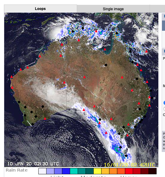
Tweet from BOM 9:30am - potential for 20mm in Gippsland!
Fingers crossed.
RAIN! RAIN! RAIN!
I call it Won-daggy.
I have heard it called ‘Moe-by-the-sea’.
rain falling in Newport
A most welcome 8mm so far in Portland. You can almost hear the garden sighing with relief.
Looking good on a national level for the next week, albeit a week late.
We are getting a good soaking in Tassie which is nice.
What stands out about the BOM rainfall maps is that 2019 was an extreme outlier for rain, or low level or rain to be specific.
But there isn’t the same obvious changing pattern as in the temperature maps. Dark red appears quite regularly over the last hundred years and dark blue maps appear this decade.
So rainfall this year will be very interesting. Maps with two or three red patches in a row in the same areas are rare. Also interesting to compare these maps to years with bad bushfire events.
Don’t disagree. Rainfall is likely to have a less direct trend than temperature, as warmth in certain ocean zones can set up temp gradients and affect prevailing wind direction to drive up rain in some areas while down in others. Either way, the predictions have been for slow overall rise in temps and more extremes in terms of floods/droughts. It would be interesting to see a chart of say rain days per year mapped over the country over those periods, and see what the anomalies look like (above versus below the long term ave). When lots of rain falls in a very high rain event, a much higher proportion would likely end up as runoff rather than soil moisture (although in irrigation areas it might end up there via pumps).
The temp charts I agree are much much clearer in trend, and as averages they don’t tell the extent of greater extreme heat days.
How anyone could look at the temp charts and suggest there’s no trend is beyond me.
We, here on the far south coast of nsw are supposed to get rain, real fair dinkum rain.
I am so looking forward to not having a dry nose and eyes from the smoke and haze.
I swear when it thunders down I am going to go out in the yard and play in the water.
For us - it will be another great miracle from the universe.