 that is insane
1 Like
There’s such massive destruction on their own territory, I just can’t imagine that UA would do that. Billions of dollars to rebuild, impacts to their own water supplies, just illogical to do.
Both sides have access to the dam. RU would have zero care about the damage to the UA territory, repair cost to rebuild in future. Heck they probably wouldn’t even care if they had hundreds of losses of their own in the flooding.
4 Likes
Ukr deliberately flooded parts around Kyiv to slow up the advance
But this would be different if it’s strongly impact on their own citizens
C’mon people we all know it’s Russia. It has all the hallmarks
7 Likes
https://twitter.com/AricToler/status/1665907128324837376?s=20
Nova Kakhovka dam before and after
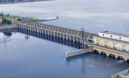
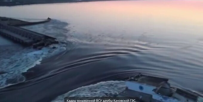
1 Like
Arguably, it’s a lot worse for the Russians, or the Russian occupied side of the river.
1 Like
Definitely Russia then
6 Likes
That is the cooling water supply to the nuclear power plant. Also, the city of Kherson is likely gone.
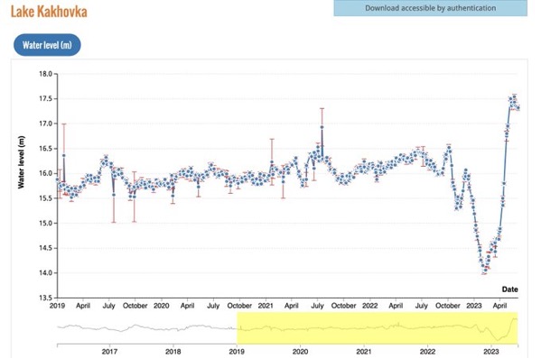
Russia has spent the last 3 months raising the water level to many meters above the previous highest level on record. Looks like they’ve blown it on purpose.
Dire.
7 Likes
The reactor draws its water a long way upstream from here, as I understand it.
More of an issue is that access to the plant will become more difficult and there is a risk to back-up generators.
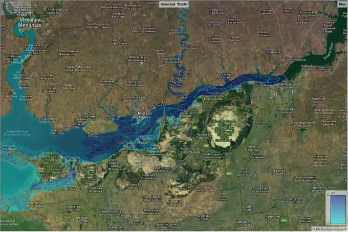
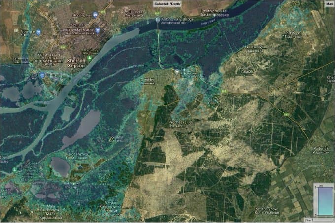
The modeling for Kherson shows that the harbour areas will be badly affected but the rest of the city should be mostly okay.
Looks great! Congratulations to the campaign waged by Mike Ryan and Ukrainian videos!!
Together with the F/A-18 Hornets news via @barry_day and @goon_squad this means it IS feasible to pressure the Australian government to do more.
I thought it was clear that Ukraine had won on both Hawkei and Abrams when I wrote 3 days ago:
Now looks like Abrams still unresolved, pilot training likely to go together with Hornets?
Focus for “Australian friends” proposed by Reznikov should now presumably be on:
-
Abrams tanks and trainers (or first tranche and other idea from @Benny40 re “loaner” Abrams from US so Australia can ship ours immediately)
-
Medevac vehicles (perhaps based on Hawkei or Bushmaster?)
-
Means of EW against drones.
Mike Ryan’s success proves a wider public campaign can have an impact.
1 Like
https://twitter.com/Osinttechnical/status/1665912991303254018?s=20
Pulling from
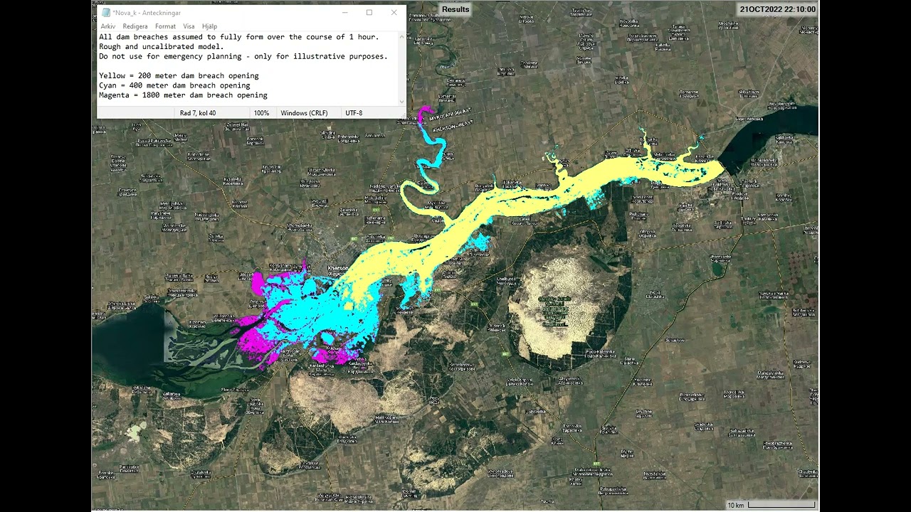
's article from last year- “A 4 – 5 m wave will hit the Antonovsky bridge east of Kherson city after 19 hours… Most of Kherson City will not flood, but the harbour and the docklands will be flooded.”
2 Likes
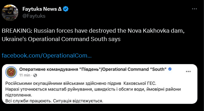
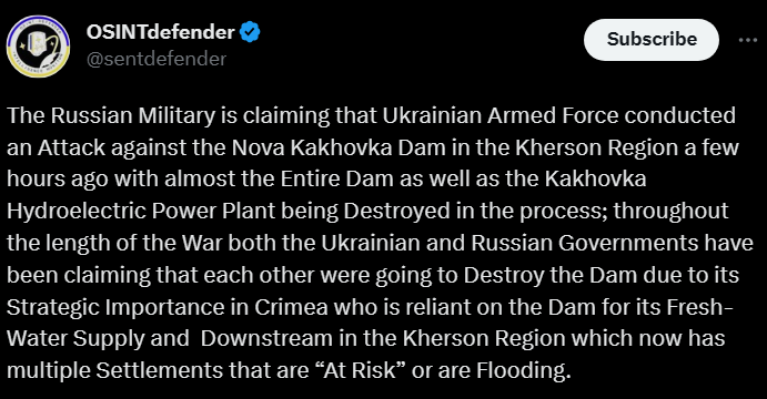
Ukraine doesn’t have the weapons to destroy 200m of a dam wall in one hit. It’s the type of job best done with explosives placed by hand.
Also, this is what Russia did to the water level over recent months.
6 Likes
There’s currently no evidence to indicate if this was a failure due to Russia overtopping the dam uncontrolled for months, intentional demolition by Russia or intentional by Ukraine.
The timing allows Russia to redeploy forces from the Dnipro to the counteroffensive. They’ve raised the water level in a way that makes this the most damaging outcome possible. They had the access from the ground to lay the explosives.
For Ukraine, this will affect the Russian side more than the Ukrainian held bank. But that’s a marginal benefit. I don’t believe they have the weapons available for this effect.
4 Likes
Sorry I was not very clear, it was just a quick follow up prompted by my two preceding comments on the recent developments south east of Bakhmut and south west of Donetsk in which I gave links to the map locations of those events.
I am not drawing lines but only speaking more vaguely of “directions”. But your lines on either side of Bakhmut roughly correspond to one half of what I was suggesting.
A Bakhmut counter offensive might also go through the center but I am suggesting that if it was able to go past Bakhmut from any or all of the two sides and center, it would be likely to pass through the area south east where Wagner is removing MoD minefields and fighting with MoD and head south to Taganarog whether it ends up on East or West side of Taganarog on reaching the coast.
I was suggesting the line could go straight south through Russian territory in the Rostov region as that might be less defended than occupied territory in the Donetsk region so I would not have the line deviating westward at the Russian border.
The other half of my suggestion is still not on your map. It goes from the area of recent feint celebrated as victory by Russia through the heavy line of black dots that used to be a front line from 2014 south east to meet up with the other force heading for Taganarog.
Agreed. The option might be completely implausible if those fortifications or the RU territory towards Taganrog (like Mariupol) have adequate enemy mobile reserve forces. Ukraine would pick some other weaker spots if they do.
But my central point was that Ukraine won’t be doing what General Hertling said:
…going against RU defensive positions that have been reinforced for 6 months.
The maps look as though there is a solid line of RU defensive positions that Ukraine has to break through. But its actually a very long line with different levels of actual defensive forces and reserves available.
The current probing will be looking for weak spots that are NOT heavily reinforced defensive positions but potential speed bumps where any thinly scattered and demoralized forces can be quickly overhwelmed.
As you say, there are many other possibilities. I was (and still am) merely referring to one that attracted my attention because of developments in the last few days.
I don’t know whether or not “least fortified areas are between Mariupol and Melitopol”. Don’t forget natural obstacles from terrain, such as rivers are just as important as “fortifications” and that the actual forces available to respond to a breakthrough both immediately and from nearby reserves are far more important - as is the actual capabilities and morale of those forces.
Ukraine would have a much better picture of these details than the enemy or any outsider viewing from social media but they can only confirm their picture by actual probing.
I certainly agree with that. But it does not have to be by pushing east to Mariupol and beyond. Could be withdrawing west from Taganrog. Also the defensive front at the old 2014 front line could be against the very large RU forces trapped on the west side with a separate defensive front against RU forces from Rostov.
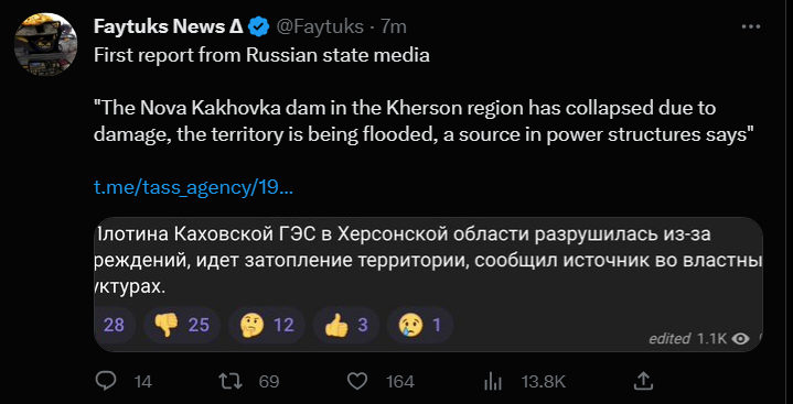
BTW the recent news of the dam blown to flood southern Kherson may indicate that either or both sides will have very different perspectives on where the weak spots are than they did just before it “happened”. Those perspectives could be right or wrong. Too early to speculate on the implications.
2 Likes
Looking at the water level in relation to the surrounding land and buildings, it could just be that it could not cope with the high water levels. Historical flooding had been reported upstream. The russians and ukrainians did damage it and blew up some of the bridge spans over and around the dam.
1 Like
The thing with hydraulic forces is that a small hole or crack can quickly develop into something of this magnitude - doesn’t take much. I still doubt it was intentional.
3 Likes
More video footage of the dam.
1 Like