Weather is coming from the north west towards the city. Will definitely cop something at the ‘G.
Perhaps NNW. Maybe not so bad.
Currently in Castlemaine for the weekend. A place it hardly ever rains.
Its absolutely pi$$ing.
Shadowing effects from Mt Macedon will reduce the impact of that NW flow.
1 Like
Got ■■■■■ Adams in Port Fairy…
1 Like
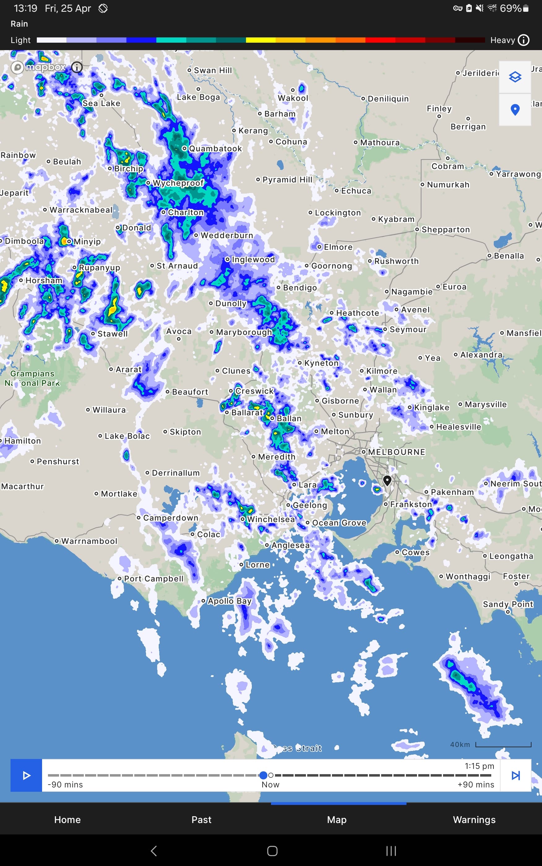
Now that’s some decent rain coming down now in Melbourne.
1 Like
This is about the absence of the wet stuff.
I walked with Mrs 10 to an excellent local restaurant for lunch today, and after lunch we walked back home. On both walks I took a 360 degree look around me.
There was literally not a single cloud anywhere in the beautiful blue sky. It has been a perfect autumn day.
2 Likes
So as indicated about a week ago, the weather models are predicting a miserable and wet long weekend next week with both Sunday / Monday marquee fixtures tracking towards a pretty ugly day(s).
@barry_day the source of truth, am I looking right at this stage still?
1 Like
Yeah, looks like winter really starts to break over the long weekend.
Kicks off early am Sunday, should bring enough snow to open some runs up on Monday if it goes to plan.
1 Like
And the models have now called a weakening g of the low pressure system meaning as of today they’re predicting less rainfall and potentially a dry Kings Birthday Eve contest.
The situation involving low pressure systems can move around and who knows where its strength and position ultimately ends up and how much rain will be landing.
It’s not weaking really.
The low is traveling through Bass Strait,
What it means is a lot of the weather will be going around Melbourne rather than through Melbourne.
Sunday is looking drier for the city, that’s for sure. The rain belt will still catch some decent falls.
If the trajectory of the low changes then we’ll see more rain in the city.
1 Like
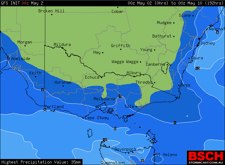
Most recent forecast I saw for Portland promises a lot of the wet stuff. We need it.
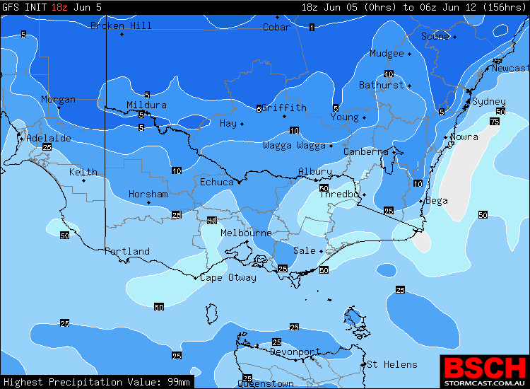
Friday 10-20mm, Saturday 20-40mm, Sunday 10-20mm, Monday and Tuesday 5-10mm.
1 Like
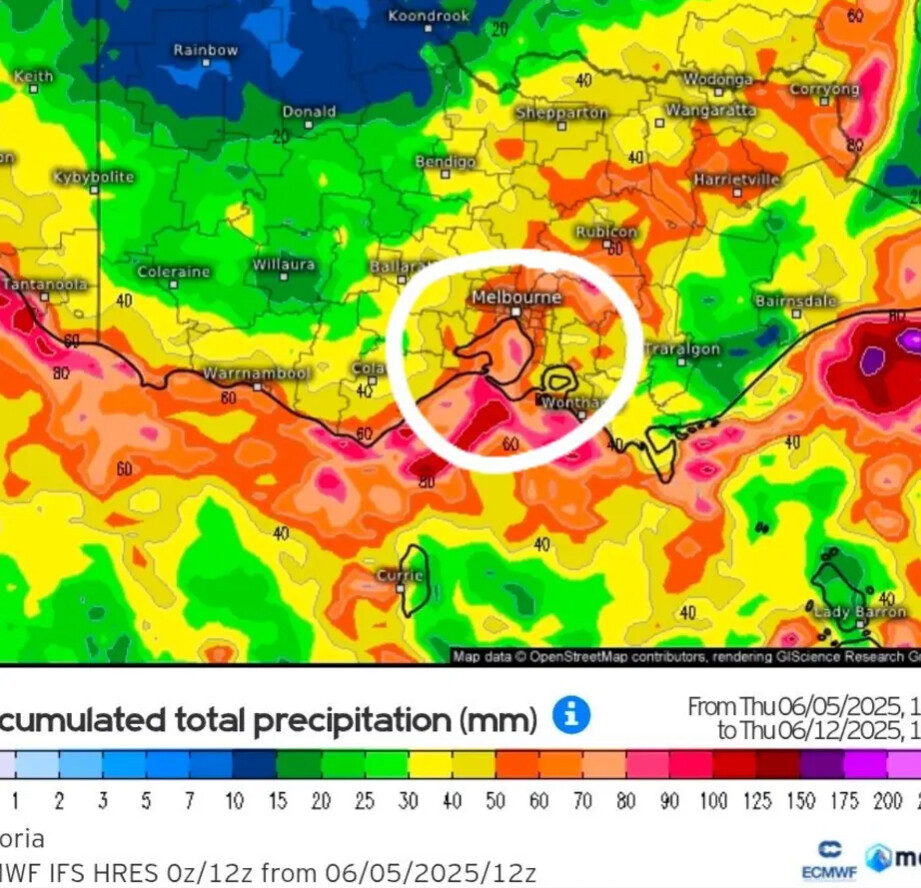
Forecast for my area yesterday was 25mm on both Sat and Sun, now down to 11-15mm. Still time for it to change again, but holy crap we need a really good drenching. All these piddly little falls of 5mm spread intermittently over the course of a day just doesn’t get through the ground vegetation and sink into the soil.
1 Like
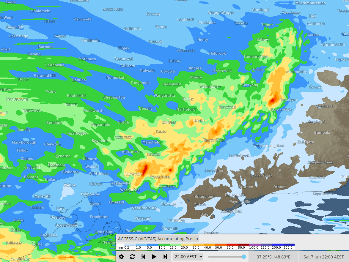
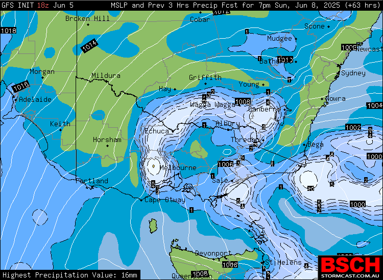
Sunday evening, you can see how it’s spinning around melbourne.
I still expect the odd shower for the game.
1 Like
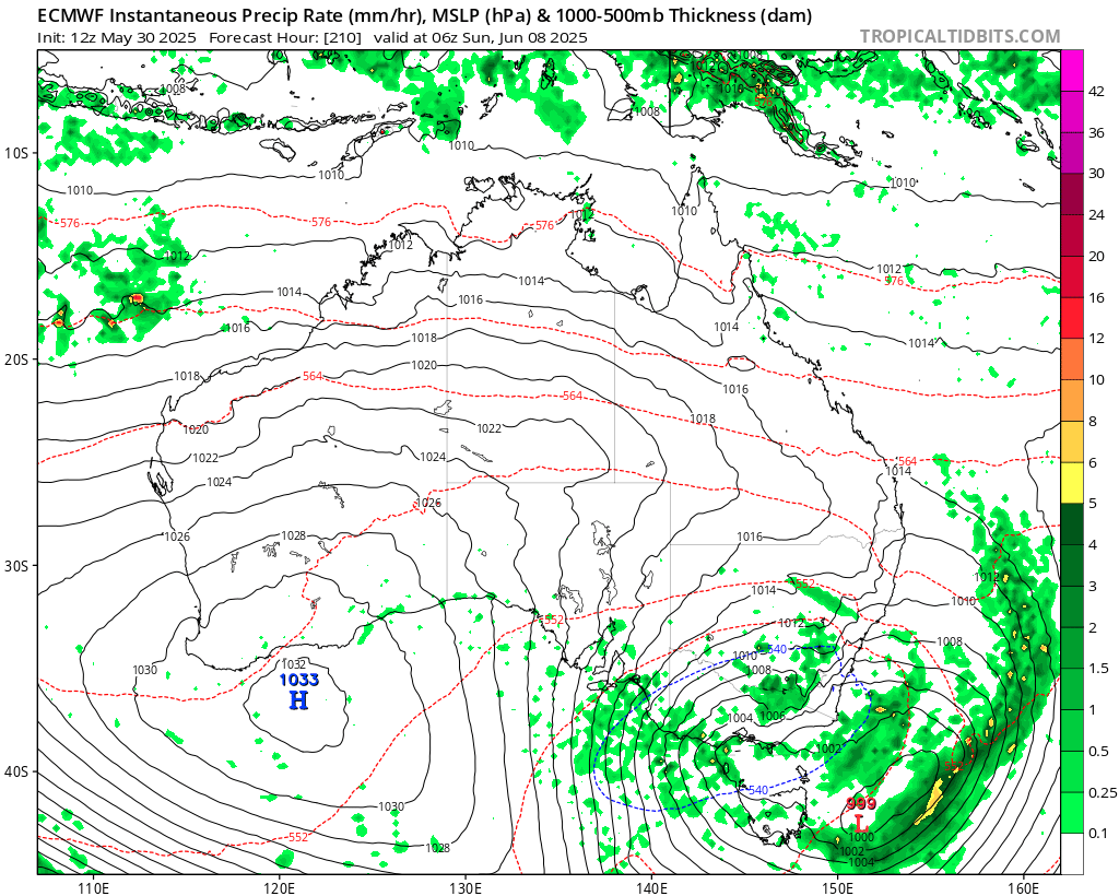
ECMWF model back to predicting more rains again with Sunday morning g and afternoon looming wet. Easing by evening Sunday?
2 Likes
Yeah, that’s how it looks on EC and GFS.
1 Like