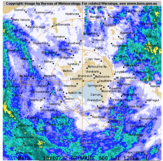
And the eye of the storm has arrived
Time to walk the dog ![]()
13mm to 9am in Port Fairy
7mm since
Steady rain, rather than heavy falls
Eildon now rising despite letting 12kML out (19 k MLday coming in at 9am, rising).
They ha had to wind back releases a bit to 10k - I guess cos it’s into downstream flooding already happening 50 or so km d/s. If the rain backs off they could sneak out without an uncontrolled spill. But if what’s NW of Melb heads east and dumps another 50 mm or more around Buller later today, I reckon it could easily spill at whatever rate is coming down all the feeders, into the existing floods further down, in which case what we are seeing now could get materially worse.
Landslides at Bogong. The Alpine region is also in trouble.
Falls Creek elected to close the road due to the risk of this happening. Not uncommon.
Not risk. There’s a slow landslide happening already.
Much less than that in Portland. We’ve been spared … this time.
Slide near Separation Creek, GOR down to 1 lane.
Sill raining.
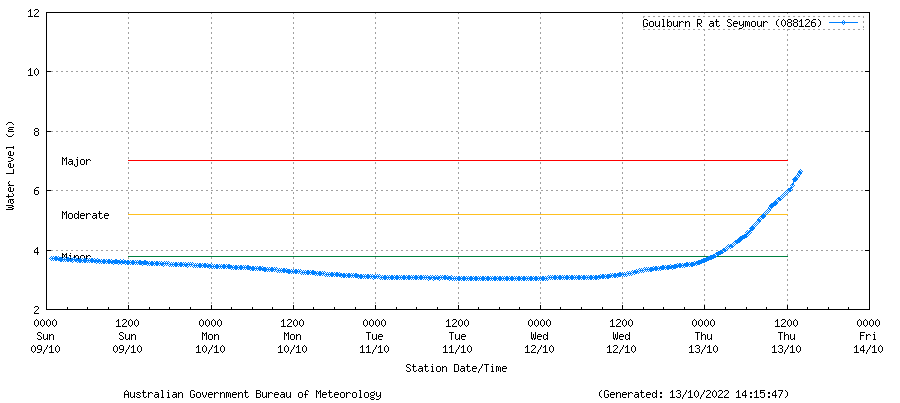
Flood warning for the Goulburn upgraded to emergency.
Hume closed southbound between Avanel and Benalla. Detouring via Shepparton.
Thought this would happen. There were many sections where water was pooling on the roadside from overflowing verges.
Flooding has impacted Echuca’s drinking water, an alert requiring people to boil water has gone out.
Does this rain this late trash what might have been a record wheat crop in the Wimmera?
Major flooding forecast for Shepp Saturday.
What’s happening at that huge dam near Tatura
Warranga Basin?
It’s about ~97% capacity.
Just realized you’re referring to the pipeline?
![]()
Both.
Dhurringile not far away